Saturday, August 25, 2007

walk #3


Some days are diamonds and this was one of them. It was all we had hoped for, 19 degrees and calm with sunshine and blue skies from time to time thought-out the day. Despite my rather poor instructions, not helped by the lack of sign-posting, we all eventually found Kings Head Road. We took two cars to Waitpinga Beach where we were going to commence the walk and left two at the bottom of Kings Head Road for the car shuttle at the end.

After the usual preparation, photos and loo stop for some, we made our way through the sand dunes heading towards the Newland Head camping ground where the Cliff Top walk begins. We discovered later that you could do a 4 hour loop back to the camping ground which would be a good alternative if you were walking on your own or didn’t have the necessary transport to walk end to end. Should note however that the very best scenery is at the latter part of the walk so walking through to Kings Head Beach is a must.

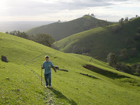
Everyone was in good spirits and walking with great enthusiasm. After nearly an hour I sensed some were beginning to wonder if the ocean and cliff tops would ever eventuate. But eventuate it did.

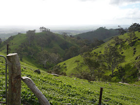
Once the cliff top is reached the walk winds its way though several small gullies, in and out of patches of eucalypt and native vegetation and boarders farmland on several occasions. The eucalypts in this area remind me of snow gums having been twisted and contorted by the ferocious winds that ply the coast.

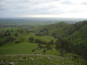
No one was disappointed with the views, they are truly glorious and continued to improve as we got closer to our destination. The many small islands off the coast looming larger, the bluff gradually taking its rightful position in the landscape and the beautifully formed coves delicately edging the base of the cliffs. We stopped many a time to take in the views and to wait for Ken! It was worth it, the views were fantastic and the photos are great.
http://picasaweb.google.com/Sticks2u


We found an elevated spot for lunch were we had a good view along the coast so that we could sit down, relax and absorb it all. All inspired, there was soon talk of an over-night walk, perhaps the Barossa with its obvious attractions. That will be something to look forward to!

It was a great day. The distance walked (12.5kms) didn’t test anyone and I don’t think anyone even missed the coffee!

Next walk at Trial Hill on Sunday, 16 September. Not called ‘Trial Hill’ for nothing, expect a climb!!!

Wednesday, August 8, 2007

walk #3 notes

Having been away for a few weeks, our third walk on Sunday, 19th August had to be one I knew well as there has been limited time for preparation.

So, subject to interest, I decided to offer a walk on the South Coast between Waitpinga Beach and Kings Head Beach adjacent to Victor Harbor. I love this walk.

I put some feelers out during the Kuitpo-Mylor walk and as interest seemed high thought I would run with it. The walk, which extends the one Chris and I did on the June long week-end, follows the Heysen Trial from the Waitpinga Beach car park inland to the Waitpinga camping ground, through the native scrub of Newland Head Conservation Park and along the cliff top all the way to Kings Head Beach. The views are to die for! I hope it will be a calm, sunny day so that everyone can see it at its absolute best.

Now that you've come this far, if you are interested in enjoying the pursuits of a fellow hiker who is well on his way to completing the Heysen Trail with The Friends by mid 2008, check out his blog - Jez-Heysen

Monday, July 23, 2007

walk #2

Well, despite my best intentions and though I swear I was not late, I was firmly put in place by being the very last to arrive at the meeting place for our walk. Next time!

It was a grand day, fine, still and lots of blue sky that held much promise. We all met at the Mylor Oval and then organised two cars to take us to Rocky Creek Hut in the Kuitpo Forest where we were to commence the walk.
There were some concerned faces as we put some distance between us and Mylor, travelling by car over hills and gravel roads, and I could see some asking though not many verbalising "how far are we walking?". Everyone was being far too polite.

We arrived
at Rocky Creek Hut to be greeted by a large group of walkers who were taking a break. They had started out from Dashwood Gully, some 4 kms south and were part of the 'End to End Walk' group (one of three!!) lead by The Friends of the Heysen Trail. So, rather than investigate the area first to get our bearings, we high-tailed it out of there to try to get some distance between us, only to run into another group on the trail (two of three!!). It was like Rundle Street in the High Country! Obviously lots of people are doing the 'End to End' walks with The Friends which is great to see.

The walk for the first four kilometres is along the perimeter of the forest reserve and there are some undulating sections before the trail meets Pocock Road. It is there that we nearly lost them! We detoured onto Pocock Road as planned to avoid a logged section of the forest which, on a prior visit, had proved rather uninspiring. The first photo of the group, minus Ken who has the camera, is taken at the point where we re-enter the forestry area. The trail eventually meets up with the Heysen Trail about a kilometre further on. As we approached the Jupiter Creek area, the vegetation changes to native bushland. We found a nice quiet spot in the sun, away from the Indians, to enjoy our lunch. And once we left there, that was it, we never saw them again. No explanation, they just seemed to vanish!

With the Indians out of sight, we journeyed on through some very picturesque farmland, over fields and board-walks, down gravel and bitumen roads. Were we 'nearly there yet'? "Nearly, just a bit further to go!" We all arrived safely having put 14+ kms behind us. It was a good effort and the coffee was great.


Many thanks to Ken for all the photos. You can view the larger images by clicking on the following link - http://picasaweb.google.com/Sticks2u

The next walk on Sunday, 19th August will be on the South Coast between Waitpinga and Kings Head Beach. Expect fantastic vistas.

Wednesday, July 4, 2007

walk #2 notes

This walk starts at Rocky Creek Hut which is just off Razor Back Road on the Heysen Trail. Follow the trail markers across Razor Back Road and along the boundary of the pine forest. After about 4 kms you will meet a gravel road on the other side of the forestry fence. This is Pocock Road. When the opportunity arises cross the fence and follow Pocock Road as it heads north. About a kilometre further on you will see a parking area and gate on your left leading back into the pine forest. The track is bounded by farmland on the northern side. Follow this track until it picks up the Heysen Trail again where it will veer right for a short distance before leaving the forestry reserve.

From this point on, follow the Heysen Trail into Mylor, passing through Jupiter Creek where old 19th century gold mine sites are dotted throughout the area. After passing through more farmland, the trail follows Glen Bold Road along a series of gravel and rough tracks.

Eventually the trail markers along the Mylor-Echunga Road will lead us into the township of Mylor. Our destination is the local cafe. I can smell the coffee from here!

planning walk #2


I promised everyone a walk on fairly flat terrain, so 'flat' I need to deliver!

A walk between Kuipto Forest and Mylor would fit the criteria but I needed to work out a good starting point because when I estimated the distance on the map it seemed quite long.

To get a gauge of the distance involved and the time it would take, I organised myself to do a bit of a scout around on Sunday, 1 July measuring a road section of the walk and then tackling a section through Jupiter Creek and the forest where I could take Maggie. In her usual style, Maggie alerted me to this little fellow in the trees, completely unperturbed by the fuss being made below!
We ventured on an soon discovered that part of the walk was through a logged area of the forest which is pretty unforgettable! I think I've devised a detour that will shorten the overall distance and add a bit more variety. It will be a good walk, long but good.

I nearly have it all sorted, just a couple of other small things to check, so I'll send out an email to everyone early next week - Rocky Creek Hut to Mylor. Has a certain ring to it!

Sunday, June 24, 2007

walk #1


Failing any last minute withdrawals, seems like there'll be 6-7 people on the walk on Sunday. That's a good number.

I was really looking forward to it until I woke up on Friday morning with a very sore throat. I'm not usually one to get sick! Not to be dissuaded, I set off on Saturday morning with Maggie in tow to work out the alternate route from Mt Lofty. That sorted, and with my cold developing rapidly, took us home for a rest. I really didn't want to cancel on the very first walk!

Decided the next morning that starting the walk from Yerang Track, opposite Sprigg Road, might be better given that I felt very ordinary and that most of those walking haven't done any significant walking for a while, if at all. This will shorten the walk by about 4 kms. There is justice for some!

We all met at Norton Summit as planned, organized two vehicles to drive us up to Summit Road and started off with lots of enthusiasm. Everyone was warmly attired and seemed in good spirits. There was lots of interaction on route. Ken with his GPS kept us informed about how many kms we had walked and took on the role of 'official walk photographer'. Unbeknownst to her, Chris was on stand-by in case we had a medical emergency, though I doubt she would have been very reassured had she seen my first aid kit! Took in great views of Adelaide and Piccadilly Valley, lunched at the ruins, saw Koalas in the trees and enjoyed a very warming coffee and/or chocolate at the Scenic Hotel.

A successful first walk I think. Everyone seemed to enjoy it. Thanks to everyone that joined me on the day - Julie, Chris, Mel, Kev, Karen and Ken - I had a great time. I just hope I haven't passed on my cold to any of you!

Here's a link to the photos that Ken has kindly shared with us -
http://picasaweb.google.com/Sticks2u

The next walk on 22 July 2007 will be on somewhat flatter terrain, but it will be a little longer!

Monday, June 18, 2007

walk #1 notes


This walk starts at the entry gates to Mt Lofty Summit. The track, which is part of the Heysen Trail, is clearly identified as the Warre Track and links back to Summit Road on the other side of Mt Lofty, some 500 metres further on. Cross Summit Road, verve to your right and cross the other bitumen road marked to Cleland Conservation Park. According to the maps, Tinline Ruins should be on your left but I couldn't see this. At this point you are able to pick up a less distinct track running parallel to Summit Road into Cleland Conservation Park. Follow this until you meet Nilee Track. Walk down Nilee Track until you meet Wine Shanty Track then turn right. Follow Wine Shanty Track until you reach Yerang Track. Just before you reach the bitumen road, a less distinct track verves off to the left running parallel to Summit Road. You will soon reach Pimpala Track. It is a short uphill climb to the crest and just after the track verves to the left a less distinct track comes off on the right and descents quickly to meet Pill Box Track. At this point you have rejoined the Heysen Trail again. Follow the Heysen Trail markers until you get to Greenhill Road. Cross the road and follow the trail along the fence line. The trail verves off to the right and after a short uphill climb you arrive at the top where there is a view over Piccadilly Valley. This would be a great place to stop for a short break.

The trail runs downhill sharply here following the fence line to Ridge Road. Walk along the road verge until you reach a blue stone house. The trail continues along the verge in front of the house and then turns to the left over a stile and continues on following the fence line. It winds behind the aviation radar tower until it reconnects again with Ridge Road. There are magnificent views to your left across the city. Follow Ridge Road until you reach Coach Road which leads to the entrance to Horsnell Gully Conservation Park.

Following the trail as it winds through Horsnell Gully Conservation Park. You will need to take care that you follow the Heysen Trail markers as there are many other waking tracks in the Conservation Park. The trail eventually starts the downhill descent into the gully. Recent rains have eroded the track. You travel downhill over many loose stones for quite a distance before it crosses a small creek. You need to be sure footed here. After a short distance, the trail winds uphill for a short distance until its reaches the ruins of an old home. This was a workman's cottage for settlers who worked for Charles Giles. He was one of the area's first settlers. Another 100m on is another ruin connected with Giles - it was once home for three gardeners and their families.

From this point the trail winds steeply uphill for a good kilometre or so. It's a tough stretch so take it slowly. You will eventually arrive at the Yurrebilla Information Board at the Woodshill Road entrance to the Conservation Park. Cross the road and follow it for 50 metres where it verves off to the right through private property. Stick to the marked trail as it winds down to Lobethal Road.

The trail follows Lobethal Road for about 300m and then verves to the right. Stay close to the road railing for safety. Shortly after passing the cemetery, the trail crosses the road into Crescent Drive past the Norton Summit Primary School. On the left are views of Horsnell Gully Conservation Park and orchards. After 700m, Crescent Drive leads into the Playford Centenary Garden with its statue of Sir Thomas Playford.

Across the road is the Scenic Hotel - a great place to stop for a coffee or refreshment.