Failing any last minute withdrawals, seems like there'll be 6-7 people on the walk on Sunday. That's a good number.
I was really looking forward to it until I woke up on Friday morning with a very sore throat. I'm not usually one to get sick! Not to be dissuaded, I set off on Saturday morning with Maggie in tow to work out the alternate route from Mt Lofty. That sorted, and with my cold developing rapidly, took us home for a rest. I really didn't want to cancel on the very first walk!
Decided the next morning that starting the walk from Yerang Track, opposite Sprigg Road, might be better given that I felt very ordinary and that most of those walking haven't done any significant walking for a while, if at all. This will shorten the walk by about 4 kms. There is justice for some!
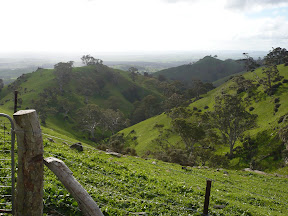
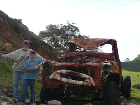
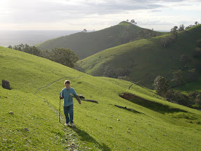
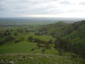
We all met at Norton Summit as planned, organized two vehicles to drive us up to Summit Road and started off with lots of enthusiasm. Everyone was warmly attired and seemed in good spirits. There was lots of interaction on route. Ken with his GPS kept us informed about how many kms we had walked and took on the role of 'official walk photographer'. Unbeknownst to her, Chris was on stand-by in case we had a medical emergency, though I doubt she would have been very reassured had she seen my first aid kit! Took in great views of Adelaide and Piccadilly Valley, lunched at the ruins, saw Koalas in the trees and enjoyed a very warming coffee and/or chocolate at the Scenic Hotel.
A successful first walk I think. Everyone seemed to enjoy it. Thanks to everyone that joined me on the day - Julie, Chris, Mel, Kev, Karen and Ken - I had a great time. I just hope I haven't passed on my cold to any of you!
Here's a link to the photos that Ken has kindly shared with us - http://picasaweb.google.com/Sticks2u
The next walk on 22 July 2007 will be on somewhat flatter terrain, but it will be a little longer!
I was really looking forward to it until I woke up on Friday morning with a very sore throat. I'm not usually one to get sick! Not to be dissuaded, I set off on Saturday morning with Maggie in tow to work out the alternate route from Mt Lofty. That sorted, and with my cold developing rapidly, took us home for a rest. I really didn't want to cancel on the very first walk!
Decided the next morning that starting the walk from Yerang Track, opposite Sprigg Road, might be better given that I felt very ordinary and that most of those walking haven't done any significant walking for a while, if at all. This will shorten the walk by about 4 kms. There is justice for some!
We all met at Norton Summit as planned, organized two vehicles to drive us up to Summit Road and started off with lots of enthusiasm. Everyone was warmly attired and seemed in good spirits. There was lots of interaction on route. Ken with his GPS kept us informed about how many kms we had walked and took on the role of 'official walk photographer'. Unbeknownst to her, Chris was on stand-by in case we had a medical emergency, though I doubt she would have been very reassured had she seen my first aid kit! Took in great views of Adelaide and Piccadilly Valley, lunched at the ruins, saw Koalas in the trees and enjoyed a very warming coffee and/or chocolate at the Scenic Hotel.
A successful first walk I think. Everyone seemed to enjoy it. Thanks to everyone that joined me on the day - Julie, Chris, Mel, Kev, Karen and Ken - I had a great time. I just hope I haven't passed on my cold to any of you!
Here's a link to the photos that Ken has kindly shared with us - http://picasaweb.google.com
The next walk on 22 July 2007 will be on somewhat flatter terrain, but it will be a little longer!